4 Policy
Week 4 focused on the applications of remote sensing to policy.
4.1 Summary
This section gives a summary of the partnership between Nairobi’s county government and the International Center for Tropical Agriculture (CIAT) and their work to promote urban agriculture for increased food security.
4.1.1 City Summary
Kenya is home to one of Africa’s fastest-growing cities, Nairobi (as can be seen in Figure 4.1). Due to this unprecedented growth, the 4 million residents have faced increasing concern about food insecurity which has become a significant challenge for their local government (Termeer et al. 2022).

The location of Nairobi can be seen in Figure 4.2

4.1.2 Policy Summary
Global Policy Overview: Sustainable Development Goals (SDGs)
The second SDG aims to end hunger, achieve food security, improve nutrition, and promote sustainable agricultural practices around the world. It forms one of the 17 global goals set by the UN as part of the 2030 Agenda for Sustainable Development.
The specific targets of SDG 2 include:
Overall, SDG 2 recognizes the critical role of sustainable agriculture and food security in achieving a more just and sustainable world. The goal aims to address the complex challenges of hunger and malnutrition by promoting sustainable agricultural practices, improving access to nutritious food, and supporting inclusive and resilient food systems.
Local Policy
The partnership between the Nairobi County Government and the International Center for Tropical Agriculture (CIAT) uses remote sensing data to work towards SDG 2 by promoting urban agriculture. This is done by mapping existing agricultural areas and using this information to support policy and planning change to allow for improved food production in the area to support local markets.
Residents and policymakers can then be informed about what factors contribute to creating successful urban agriculture within Nairobi, and where best to develop further agricultural land. This is in addition to community-led programmes being rolled out to engage the youth and women in urban agriculture. Allowing the development of understanding regarding the benefits and limitations of Nairobi’s urban agriculture plans.
Overall, this policy is working to promote the use of sustainable agricultural practices to improve food security for the residents of Nairobi, a concern that has been growing in recent years.
4.2 Application
This section will identify how the remotely sensed data that was sourced could be used to contribute to the policy goal, answering the question: ‘How could the data be applied to solve the policy challenge?’
Nairobi and their partner do not specify the methodology used in their urban agricultural mapping project, but here is some general information on the uses of remote sensing data sources and techniques they may call upon for their analysis.
Data Sources
It is most likely that satellite imagery is employed to help Nairobi in its battle against food insecurity, due to its relatively inexpensive nature. Satellite sensors such as Landsat, and Sentinel provide global monitoring of high-resolution multispectral imagery that can be used to identify vegetation and land cover.
Though still possible, it is less likely that Unmanned Aerial Vehicles (UAVs) are used, due to their more expensive nature. However, their even higher-resolution cameras would allow for an in-depth analysis providing detailed vegetation cover and crop health statistics.
Techniques
Crop Monitoring
Land Use Mapping
Early Warning Systems
Food Security Assessment
4.3 Reflection
This section works to answer the question ‘What you have learnt about the policy, city and the application of the data?’
Nairobi has used remote sensing imagery to help identify existing and potential urban agricultural areas to ensure food security is maintained or improved for its residents. Though the city (or its partner) has not specified their methodology, it is likely they are making use of crop monitoring, lane use mapping, early warning systems, and food security assessments to support the development of future policy in this area. This has allowed for data-informed decisions to be made, and early interventions to be taken prior to extreme weather conditions that would have plunged Nairobi’s residents into food insecurity. Nairobi’s issue with food security is not an uncommon one. The use of remote sensing techniques to advise policy related to SDG 2 could be of benefit across the world, specifically in arid regions (identified in Figure 4.3).

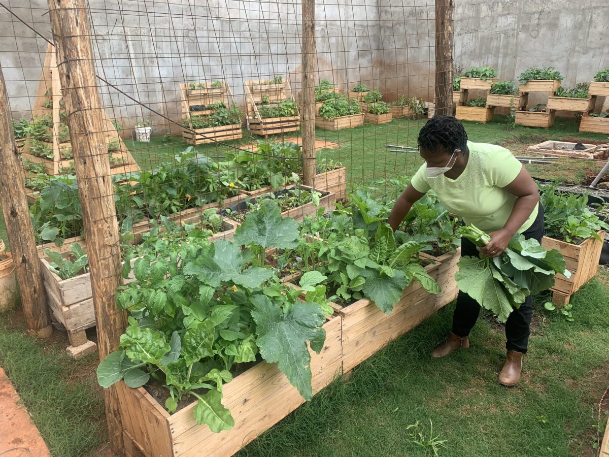
An output of the policy can be seen in Figure 4.4, which appears to be a neatly arranged urban agricultural area featuring thriving crops.