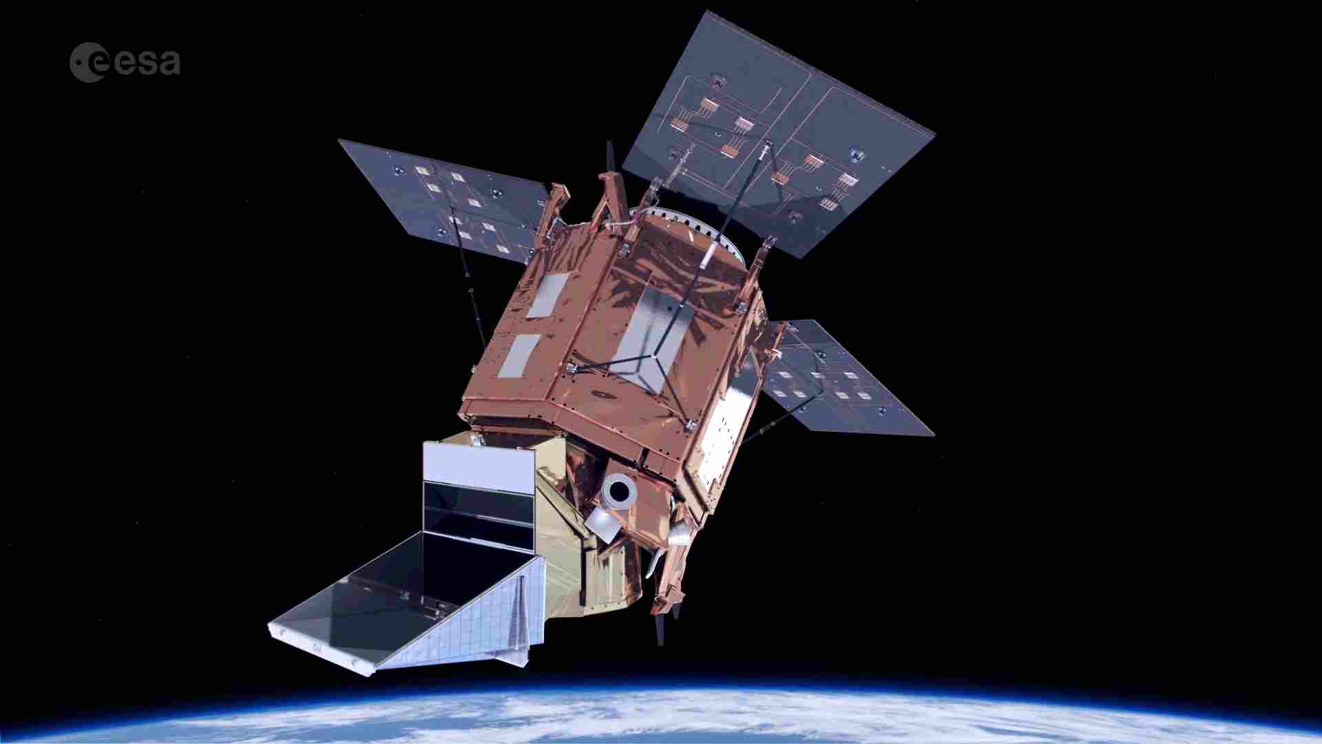
class: center, middle, inverse, title-slide .title[ # Sentinel 5P ] .subtitle[ ## CASA0023 ] .author[ ### by Zachary Pescod-Everiss ] .institute[ ### CASA, UCL ] .date[ ### 2023/01/25 (updated: 2023-03-27) ] --- <style>.xe__progress-bar__container { bottom:0; opacity: 1; position:absolute; right:0; left: 0; } .xe__progress-bar { height: 0.25em; background-color: #32064A; width: calc(var(--slide-current) / var(--slide-total) * 100%); } .remark-visible .xe__progress-bar { animation: xe__progress-bar__wipe 200ms forwards; animation-timing-function: cubic-bezier(.86,0,.07,1); } @keyframes xe__progress-bar__wipe { 0% { width: calc(var(--slide-previous) / var(--slide-total) * 100%); } 100% { width: calc(var(--slide-current) / var(--slide-total) * 100%); } }</style> # Summary .pull-left[ Launched in 2017 by the European Space Agency, part of their Copernicus program. Orbits at altitude of 824km Measuring pollutants in Earth's atmosphere, including: - Ozone (O3) - Nitrogen Dioxide (NO2) - Sulfur Dioxide (SO2) - Methane (CH4) - Carbon Monoxide (CO) Cost: €45.5 million ] .pull-right[ <!-- --> Image credit: [European Space Agency](https://www.esa.int/Enabling_Support/Operations/Sentinel-5P_operations) ] --- # Summary: Resoloution - 1 day revisit time - The Sentinel 5p sensor has 3 instruments: Tropomi, IASI-NG, and Pandonia. Tropomi is the main instrument and has a swath width of **2,600 km**. - It operates in the ultraviolet, visible, near-infrared, and shortwave-infrared spectral ranges. <img src="https://imageio.forbes.com/specials-images/imageserve/6398de50fd70c4aa61f47d8b/EOI-Space-VLEO-satellites-/960x0.jpg?format=jpg&width=360" style="display: block; margin: auto;" /> Image credit: [Forbes](https://imageio.forbes.com/specials-images/imageserve/6398de50fd70c4aa61f47d8b/EOI-Space-VLEO-satellites-/960x0.jpg?format=jpg&width=960) --- class: inverse, center, middle # Summary: Limitations ####Limited Spatial Resoloution: The spatial resolution of Sentinel 5p is relatively coarse compared to other satellite sensors. ####Limited Crossover: The sensor is primarily designed to monitor atmospheric composition, so it may not be suitable for other applications. --- # Applications: Overall <div id="htmlwidget-5229f615b7ea12c05f37" style="width:504px;height:504px;" class="grViz html-widget"></div> <script type="application/json" data-for="htmlwidget-5229f615b7ea12c05f37">{"x":{"diagram":"digraph {\n \ngraph[layout = dot, rankdir = LR]\n\na [label = \"Sentinel-5P\", shape = square, fillcolor = Black]\nb [label = \"Climate Research\"]\nc [label = \"Air Quality Monitoring\"]\nd [label = \"Volcanic Ash Monitoring\"]\n\n\na -> {b c d}\n}","config":{"engine":"dot","options":null}},"evals":[],"jsHooks":[]}</script> --- # Applications: Air Quality Monitoring 1 #### Concentrations of pollutants can be monitored using Sentinel-5P. .pull-left[ The Tropomi sensor is designed for atmospheric monitoring, quantifying concentration of pollutants. These pollutants have potential negative effects on the environment and human health. - Sentinel-5P data provides key information on the wider-scale sources of pollutants. - It's data can validate air quality models, allowing better understanding of the pollutants behaviours. ] .pull-right[ <!-- --> Image credit: [Eos](https://eos.org/articles/advanced-satellite-tracks-air-pollution-in-extraordinary-detail) ] --- # Applications: Air Quality Monitoring 2 #### Assessment of Factors Influencing Air Quality - One study used spatial-temporal analysis to identify factors impacting NO2 concentration in China based on the data from Sentinel-5P TROPOMI. The results reveal monthly fluctuations and a "high in East and low in West" spatial pattern, and identify positive correlations between NO2 concentration and nighttime light intensity, secondary and tertiary industries proportion, whole society electricity consumption, and vehicle ownership in certain regions ([Zheng, Yang, Wu et al., 2019](#bib-zheng2019)). - A different study identified changes in spatial NO2 distribution over Europe between similar periods in 2019 and 2020, based on the ESA Copernicus Sentinel-5P products. Results reveal a remarkable decrease of tropospheric NO2 concnetration even up to 85% in some European cities during the COVID-19 lockdown period, all supported by ground truth data ([Vîrghileanu, Săvulescu, Mihai et al., 2020](#bib-virghileanu2020)). --- # Reflection - Sentinel 5P appears to be a method with increased spatial resolution and reproducibility when compared to its existing counterpart (ground measurements) for conducting air pollution research. Allowing for the evaluation of air quality mitigation measures. - However, the spatial resolution of Sentinel-5P is limited to 7 km, which can restrict its applications in identifying and monitoring small-scale sources of atmospheric pollution or atmospheric phenomena. Nonetheless, it remains a useful tool for monitoring the overall state of the atmosphere on a global scale. <img src="https://gisgeography.com/wp-content/uploads/2015/10/Spatial-Resolution-Comparison.png " width="75%" style="display: block; margin: auto;" /> Image credit: [GIS Geography](https://gisgeography.com/wp-content/uploads/2015/10/Spatial-Resolution-Comparison.png ) --- # Reflection #### Future Developments - The European Space Agency is planning to launch the Sentinel 5p Second Generation satellite in 2023. - This satellite will have improved capabilities and will be able to monitor additional pollutants such as methane and formaldehyde. <img src="https://www.esa.int/var/esa/storage/images/esa_multimedia/videos/2017/08/sentinel-5p_on_rockot/17112710-1-eng-GB/Sentinel-5P_on_Rockot_pillars.png" width="70%" style="display: block; margin: auto;" /> Image credit: [ESA](https://www.esa.int/var/esa/storage/images/esa_multimedia/videos/2017/08/sentinel-5p_on_rockot/17112710-1-eng-GB/Sentinel-5P_on_Rockot_pillars.png ) --- # References <a name=bib-virghileanu2020></a>[Vîrghileanu, M., I. Săvulescu, B. Mihai, et al.](#cite-virghileanu2020) (2020). "Nitrogen Dioxide (NO2) Pollution Monitoring with Sentinel-5P Satellite Imagery over Europe during the Coronavirus Pandemic Outbreak". In: _Remote Sensing_ 12.21, p. 3575. <a name=bib-zheng2019></a>[Zheng, Z., Z. Yang, Z. Wu, et al.](#cite-zheng2019) (2019). "Spatial Variation of NO2 and Its Impact Factors in China: An Application of Sentinel-5P Products". In: _Remote Sensing_ 11.16, p. 1939.